My last (major) hike of 2021. Two years ago we did a hike in the southern portion of the Wind River. We also went in September, but two days in as we crossed the Continental Divide we got hit with a blizzard! I learned that my Sierra clothing was not sufficient and we cut the hike short.
This time Scott joined us – both for planning and execution. We still had weather, but it was a great 7 full days in the region.
Wind River is NOT the Sierra. It has a very different feel and look. I don’t think it’s as varied as a typical Sierra hike, but the terrain has characteristics that you just don’t find in California. We spent most nights above 10,000 ft and even did a pass at almost 12K. The Continental Divide (we cross over it and spent a night “on the other side”) had sharp peaks, similar to the Kaweah mountains. Some regions were above tree line, but most had yellow shrubs.
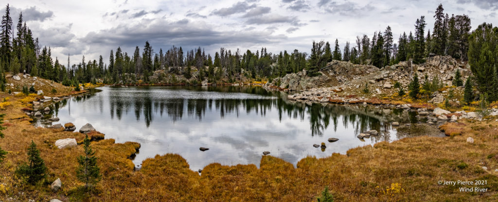
And the LAKES! Everywhere we turned were more LARGE lakes. In the Sierra they would be destination lakes, but here most are not even named.
And we did have WEATHER. Lots of clouds (I love clouds for pictures), trail rain for two of the days and two nights of rain. (And hail and frozen ice.) I learned that my tent was good for Sierra, not as good for Wyoming.
Here is the .gpx of the trek: https://jerrypierce.org/Files/2021-WindRiver-Full-Track.GPX
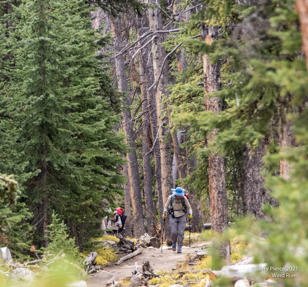
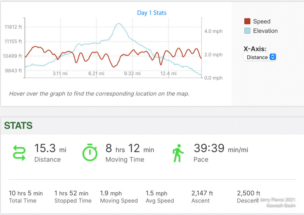
First day from Elkhart Trailhead
Our Wyoming adventure started with DRIVING. I left Boise for the 7+ hour drive to Pinedale starting at about 4am. Aiming to arrive at the exit trailhead at about 11am. Pat, Jim and Scott had driven from California the day before and stayed somewhere that morning. Car left at Scab Creek Trailhead, we shuttled past Pinedale to the Elkhart trailhead up Pole Creek Trail by about 1pm to start the hike.
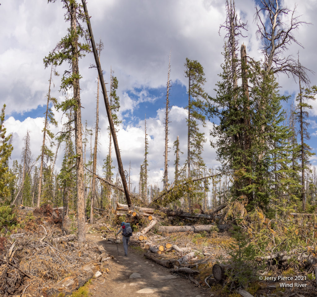
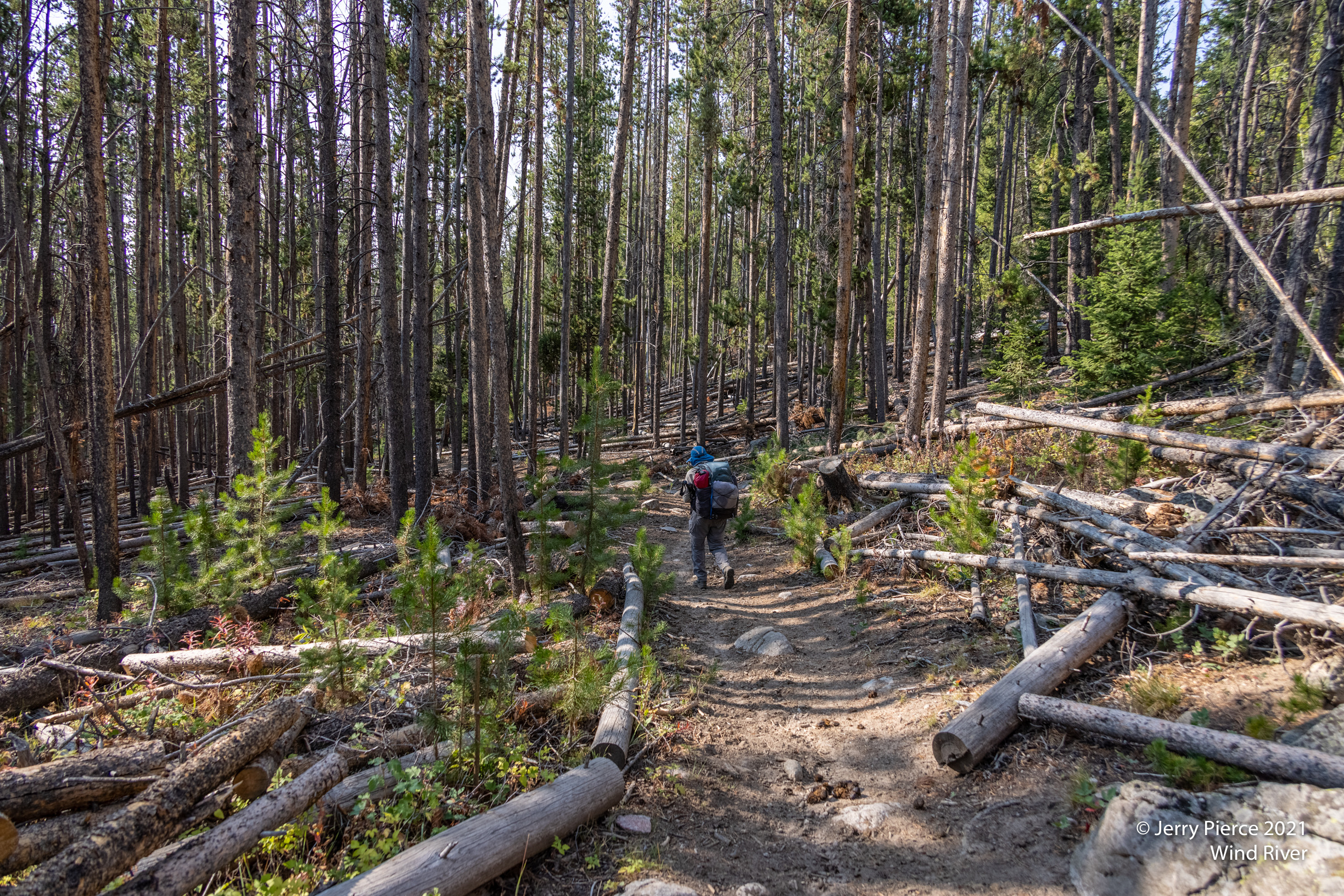
I was in shorts and ready for a nice 8-ish mile first day. (We are serious “get to the destination” types.) First thing we find is that there must have been a wind event in the last few years as there are downed trees everywhere! The trail was well maintained and trees had been cut, but we were thinking that our off-trail sections could be challenging! (Ended up not being the case.)
We passed many hikers on their way out. Lots of fishermen, but recreational hikers as well. (It was Friday of Labor Day, so maybe they had taken the week off?)
A few miles in the clouds began to give us some sprinkles and turned to rain. We soon layered up with our rain gear and continued hiking. This was one of my shortcomings from last Wind River adventure – I didn’t bring the right rain gear – this time it was fine!
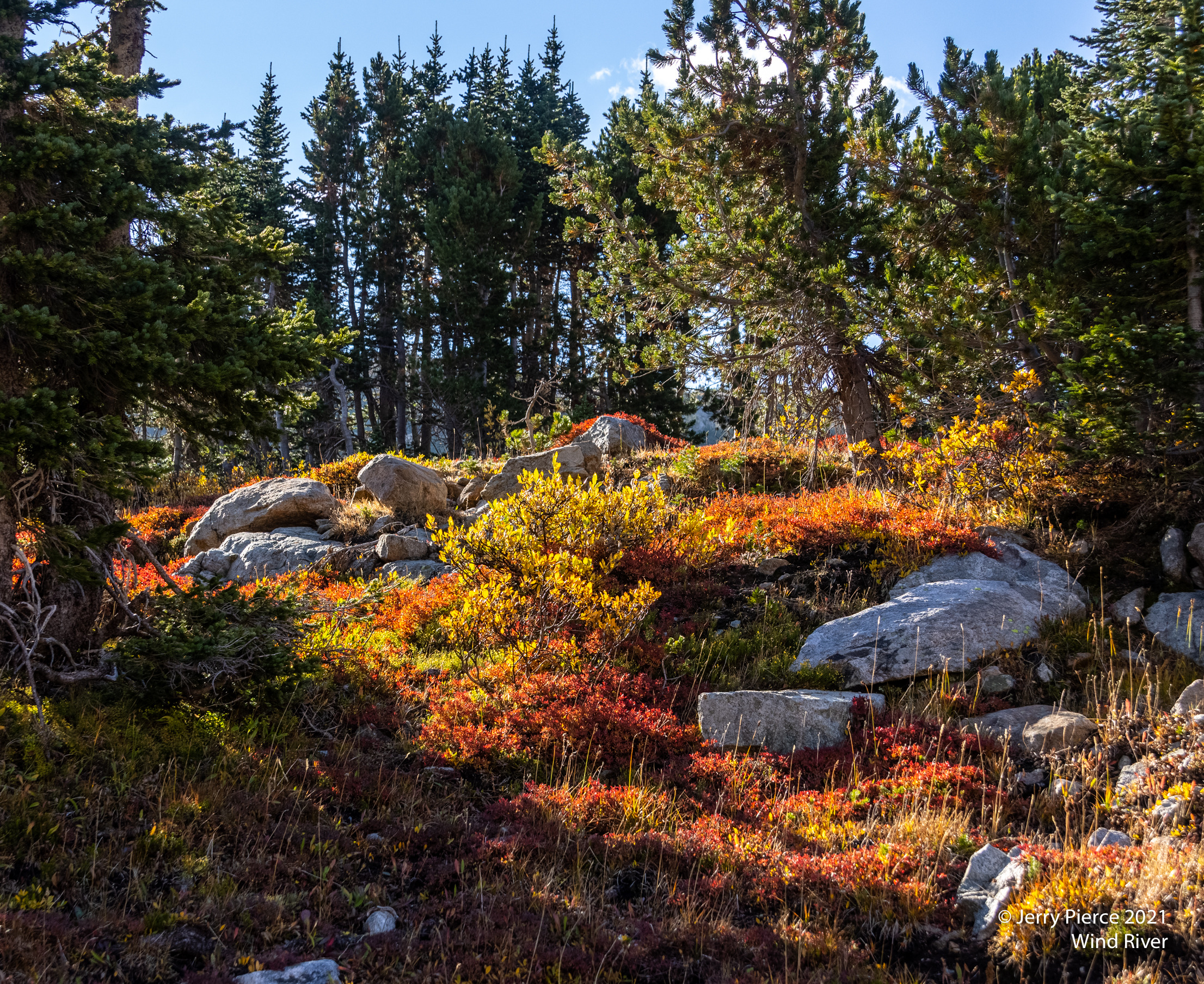
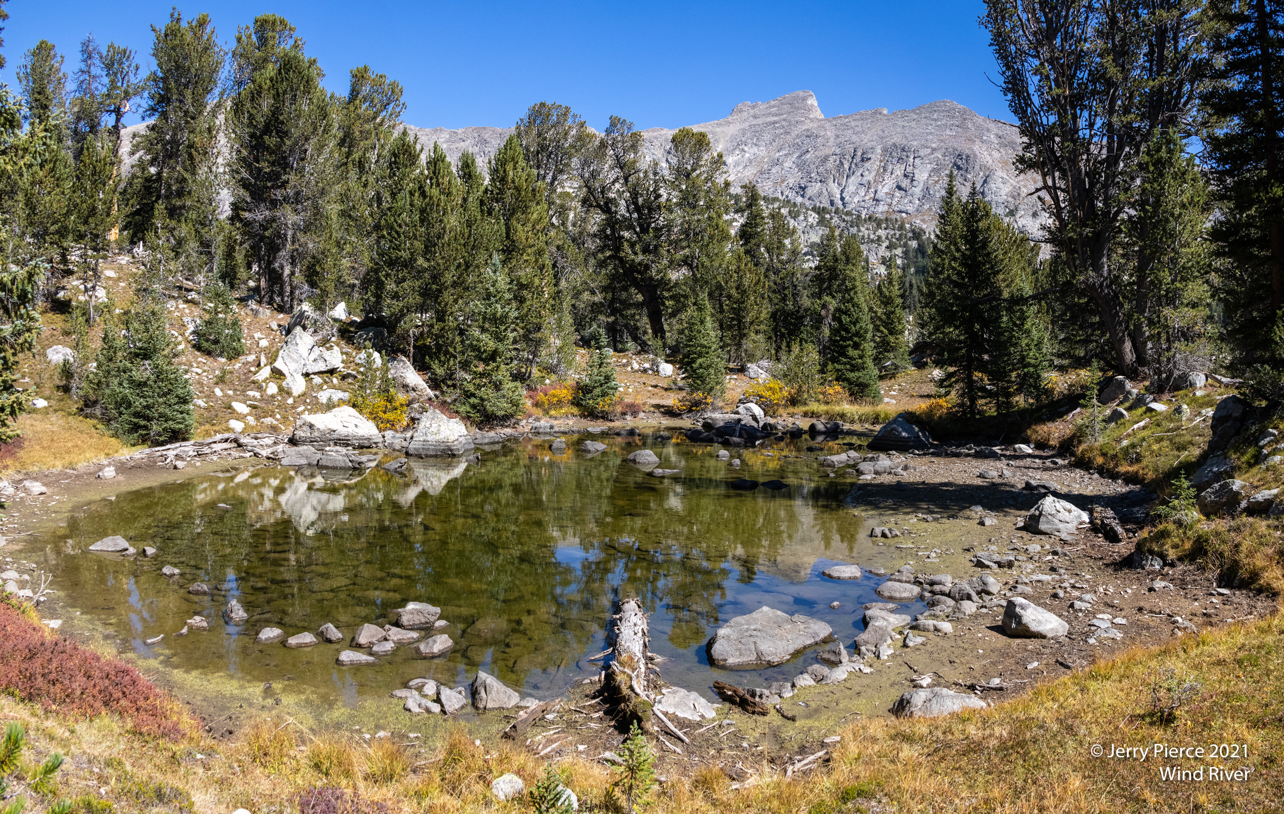
We began to pass lots of lakes and wonderful clouds. I know that many of these lakes are named on the Wind River maps, but they don’t have names on the USGS or Gaia maps. The typical color of the shrubs – I’m not sure if that’s there year round color, or their winter color. But it makes for striking contrasts.
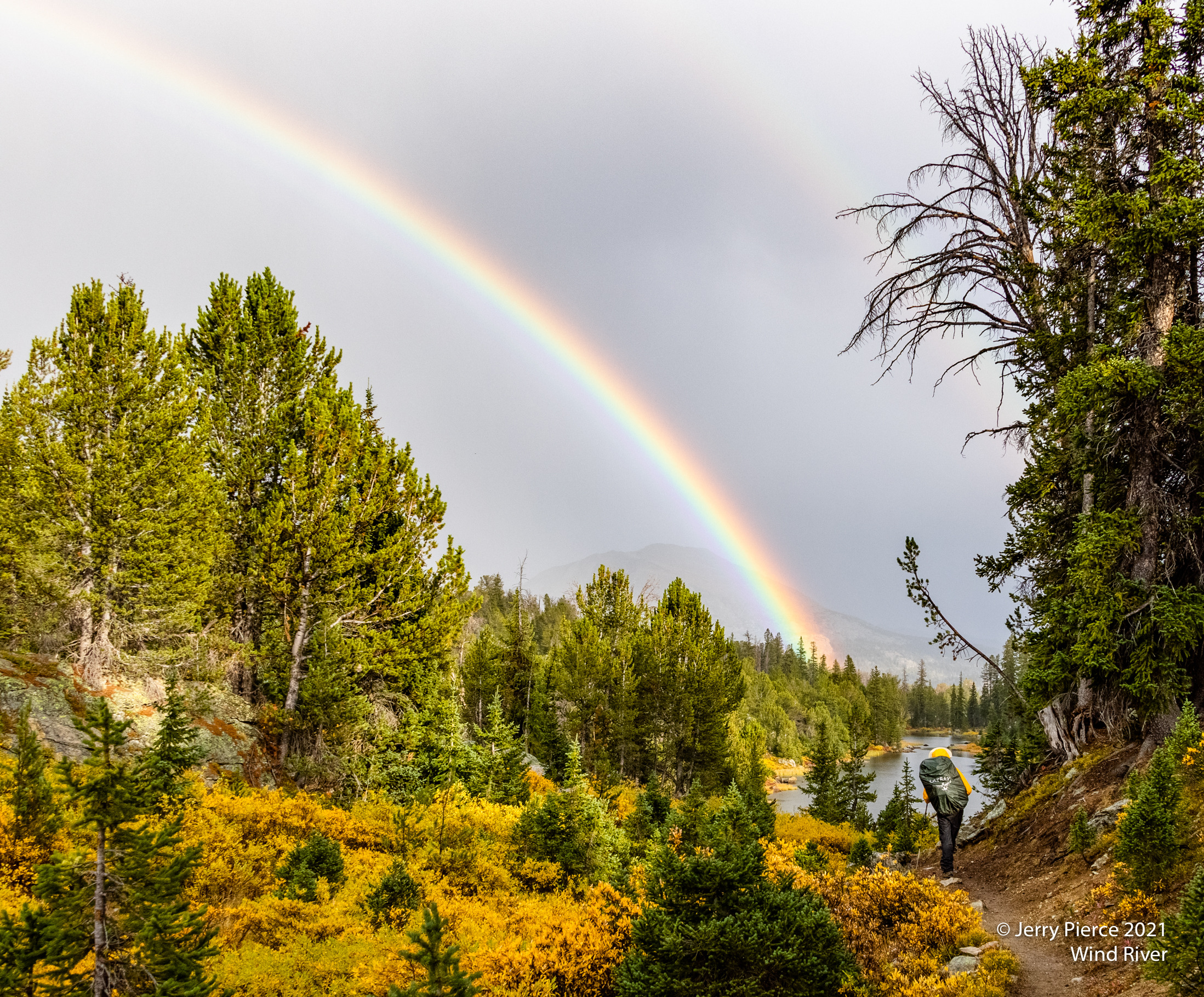
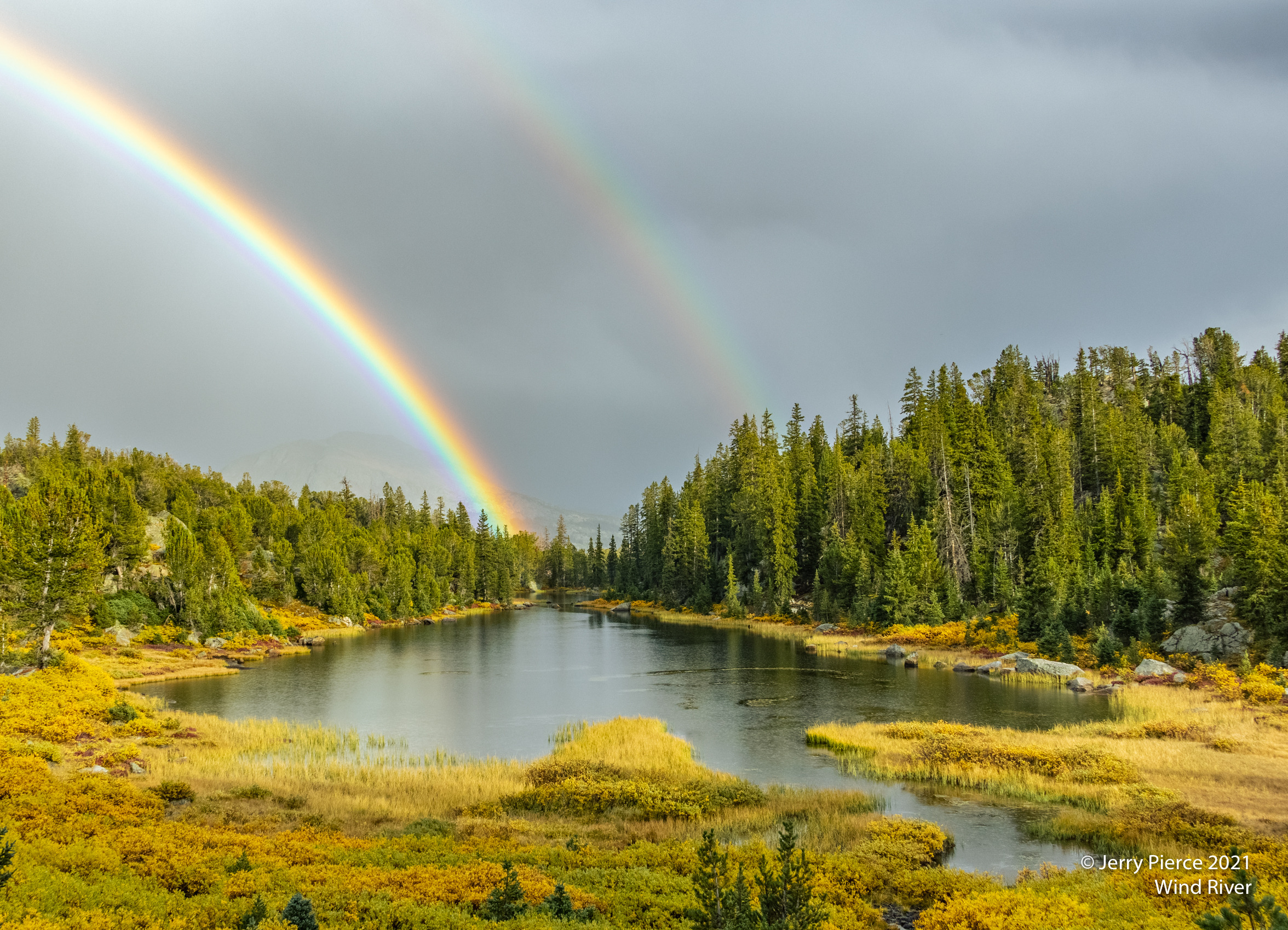
At the end of the day we came to “Spade Lake®” with one of the brightest double rainbows I have ever seen! I guess it was worth the price of hiking in the rain! We set up came at the end of this lake. Not much more rain for camp set-up and dinner, but light sprinkles during the night. We were a few miles short of our goal for the first day. We felt we could make it up.
Here is where I found that my tent is really great for the Sierra, but not so great when there’s wind AND rain. My rainfly directed water into my tent. Nothing got badly soaked, but I did have a puddle at my feet. (Note to self: do a better job of setting the tent and/or get a better designed tent.)
Two of the three of us had packed up ready for the day before rain started in the morning. Scott was encouraged to packup and THEN it began to really rain/hail while the tent was coming down. Oops.
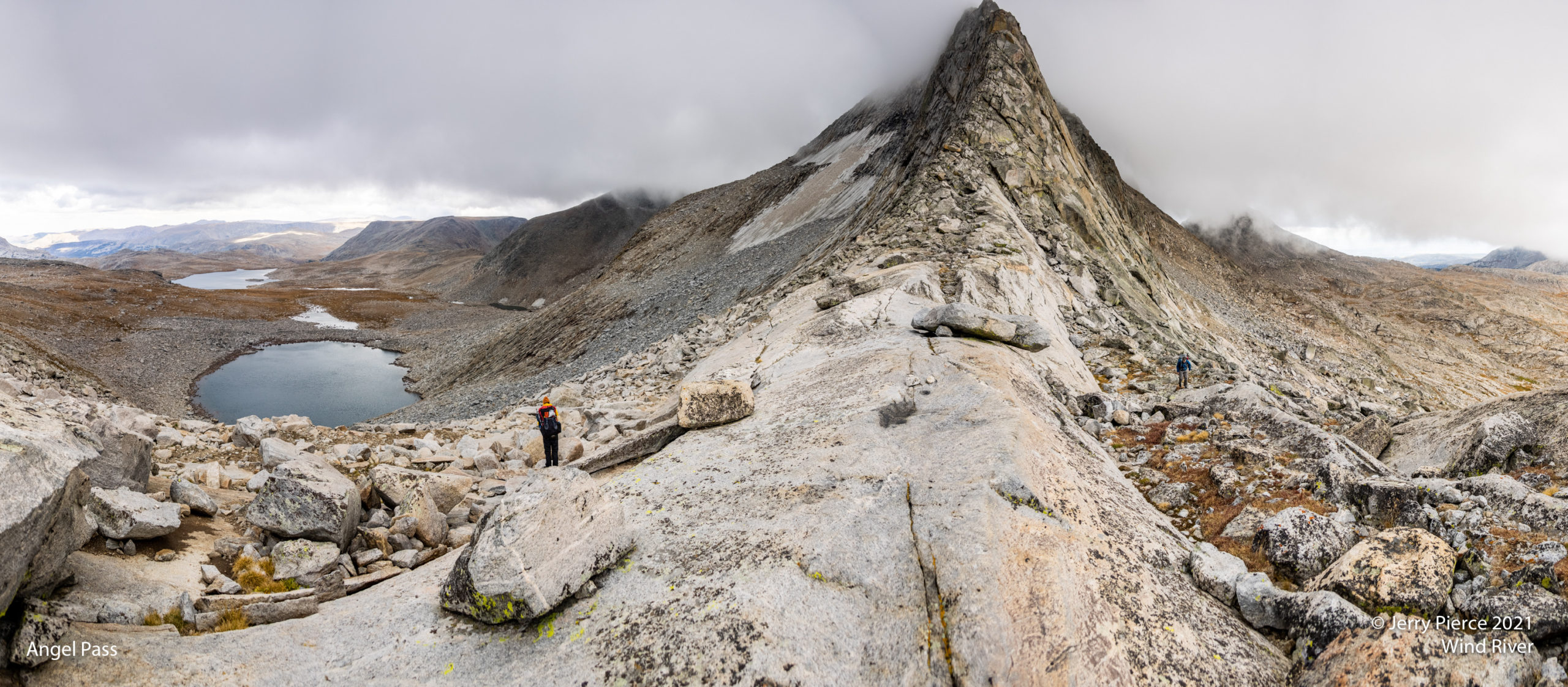
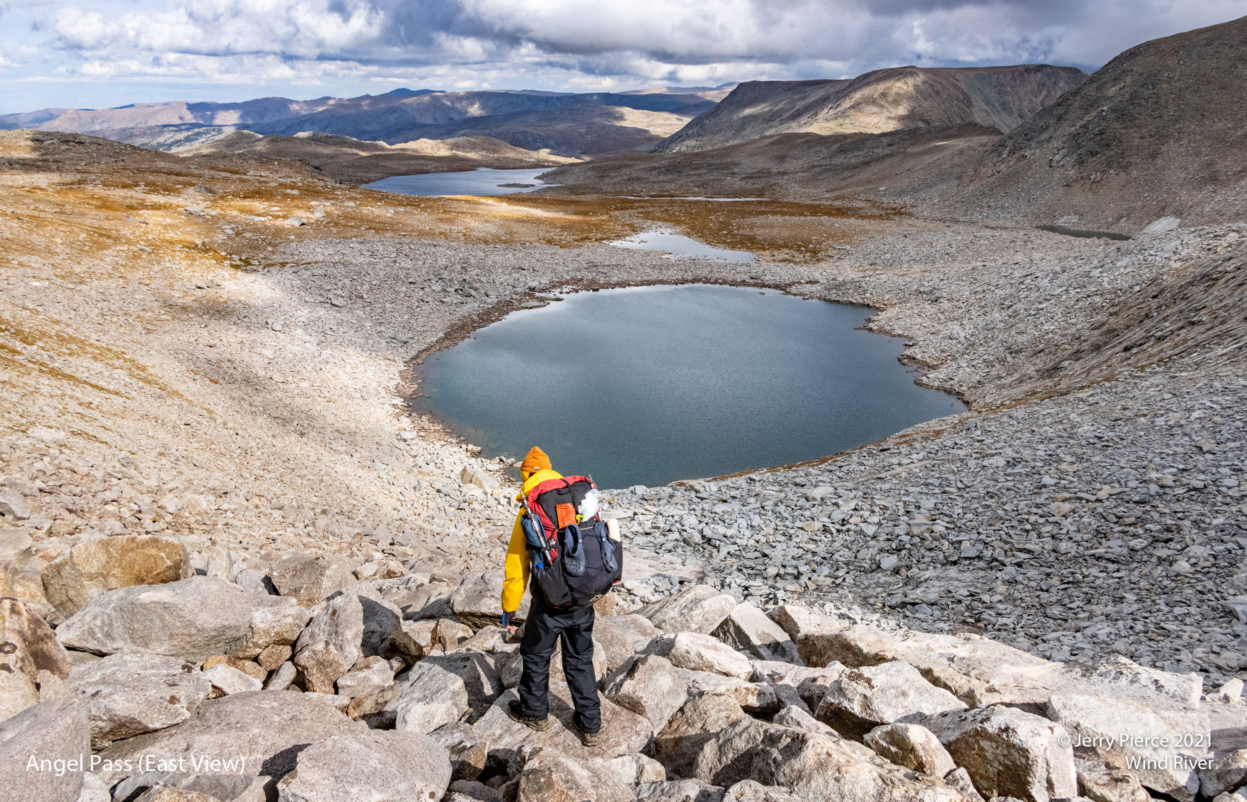
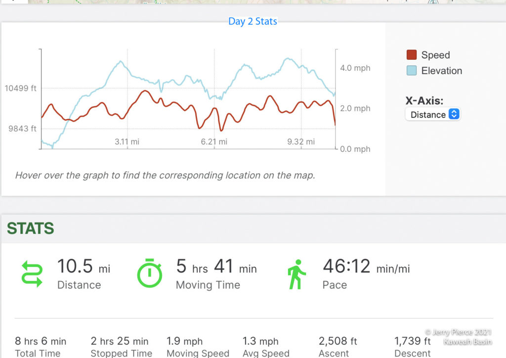
Our first off-trail for this trip was Angel Pass. The cloud cover was pretty heavy as we headed toward the pass. We decided that we needed to see the pass (it wasn’t in the clouds) or we would re-route to stay on trails. On command the clouds parted and there was Angel Pass! So off trail we went!
Not a hard pass (class 2), but lots of rock hopping and route finding. Sort of a zig-zag all the way up. A really impressive view of the Spider Lakes back the way we came.
The top of Angel Pass was pretty stark. The clouds were kind to us, but they did threaten!
It took us longer to get over Angel Pass (and to the other side of the Continental Divide) so we were running behind schedule. Looking out the east side, there didn’t seem to be many good spots for camp sites! It was windy (and chilly) so we were hoping for protection. We found a few possible sites, but Scott suggested we move on! And we found a great site! Once again we were only a few miles short of our goal for the day.
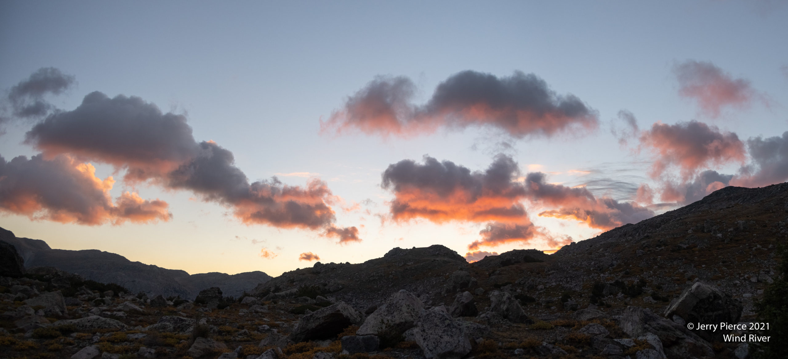
Not only a nice campsite, also a good light show!
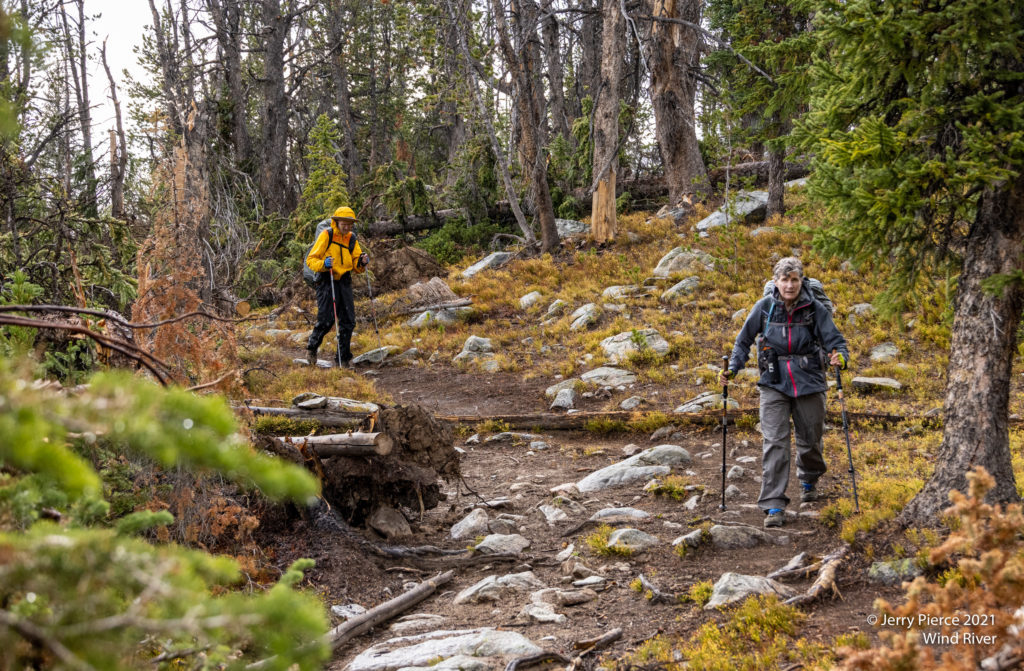
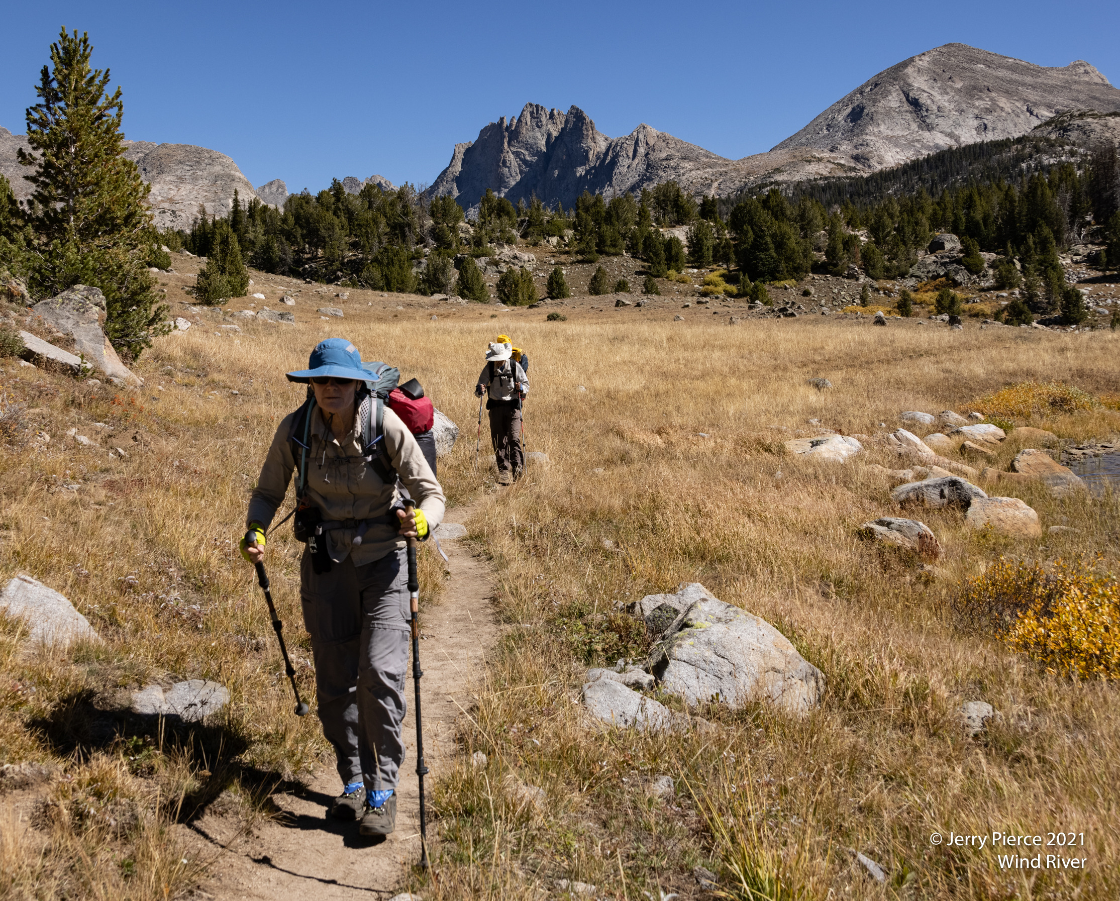
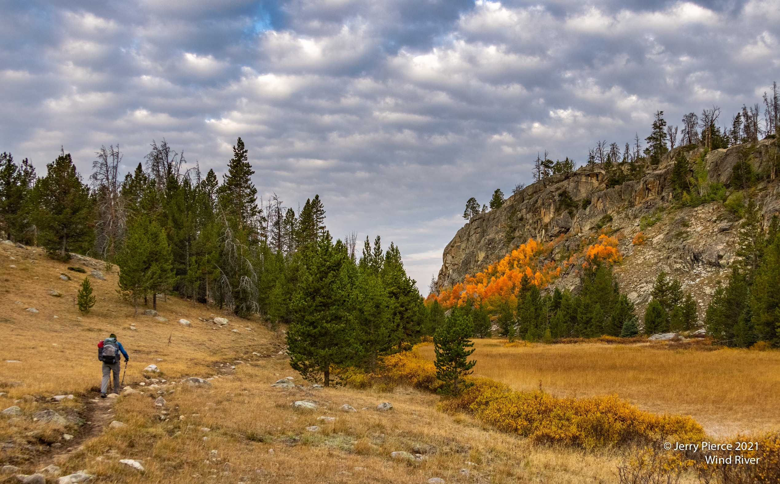
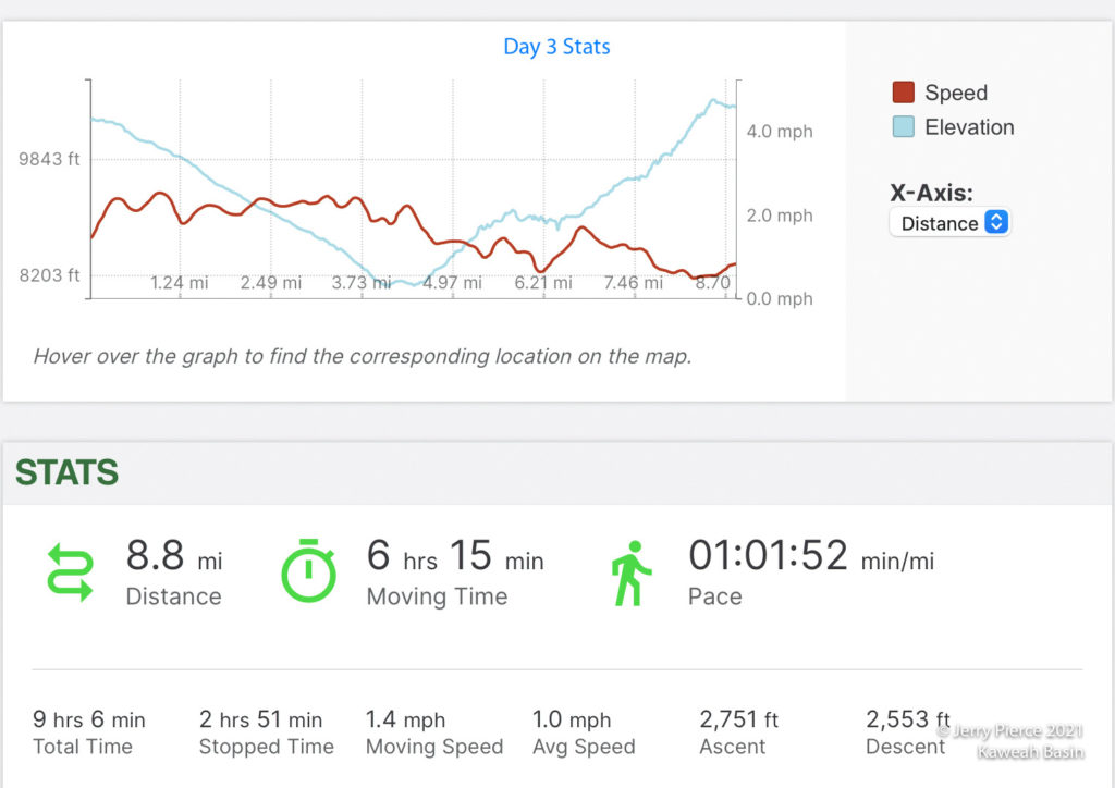
The next day we did a short-cut next to Lake Louise – which was our target for the night before. A wide variety of colors and foliage everywhere – looking pretty, but as a hiker not something we wanted to “bushwhack”our way through. Rocks/Trees/Bushes — generally we could choose rock hopping over scraping our legs. (By this time I had abandoned short pants.)
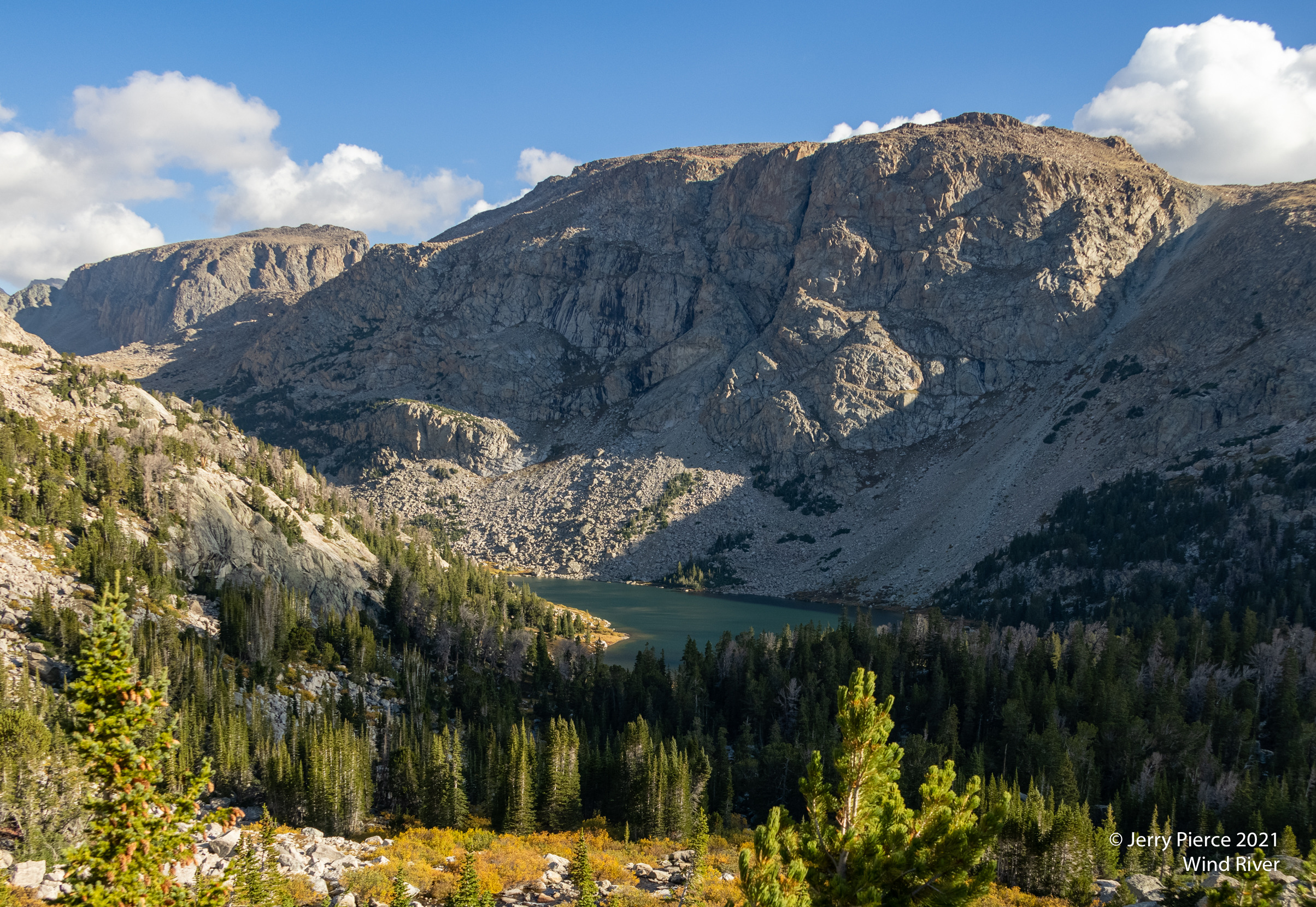
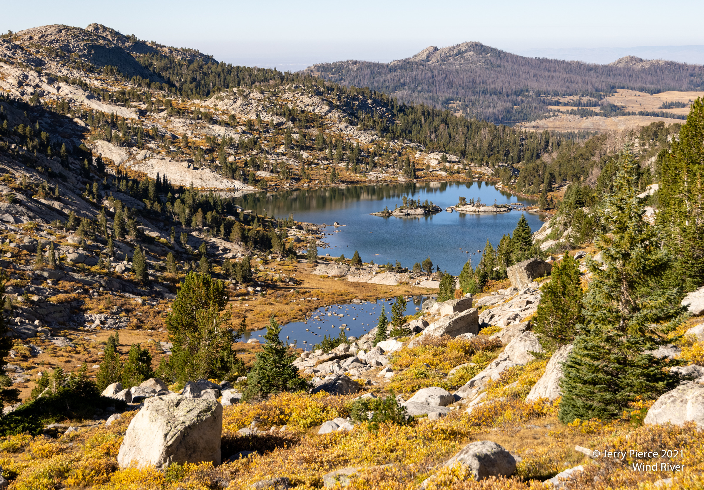
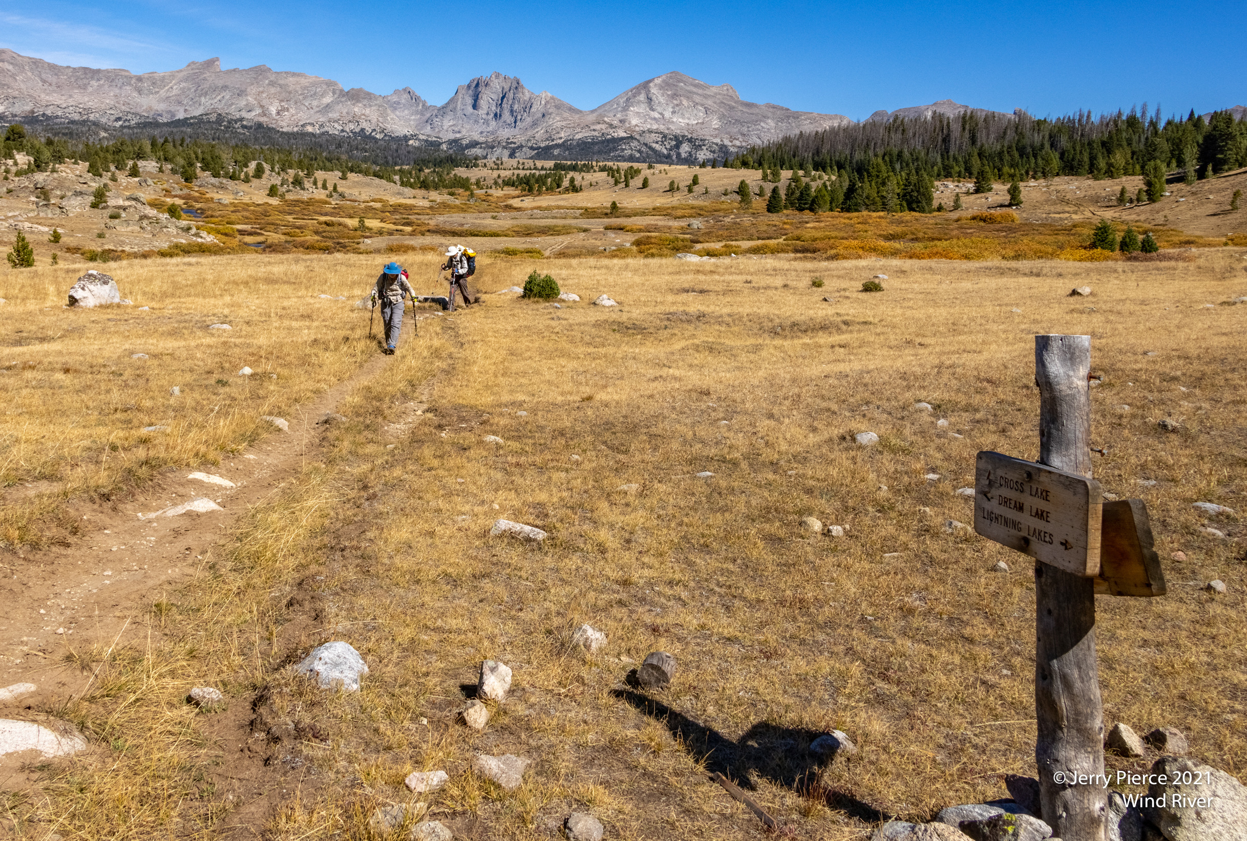
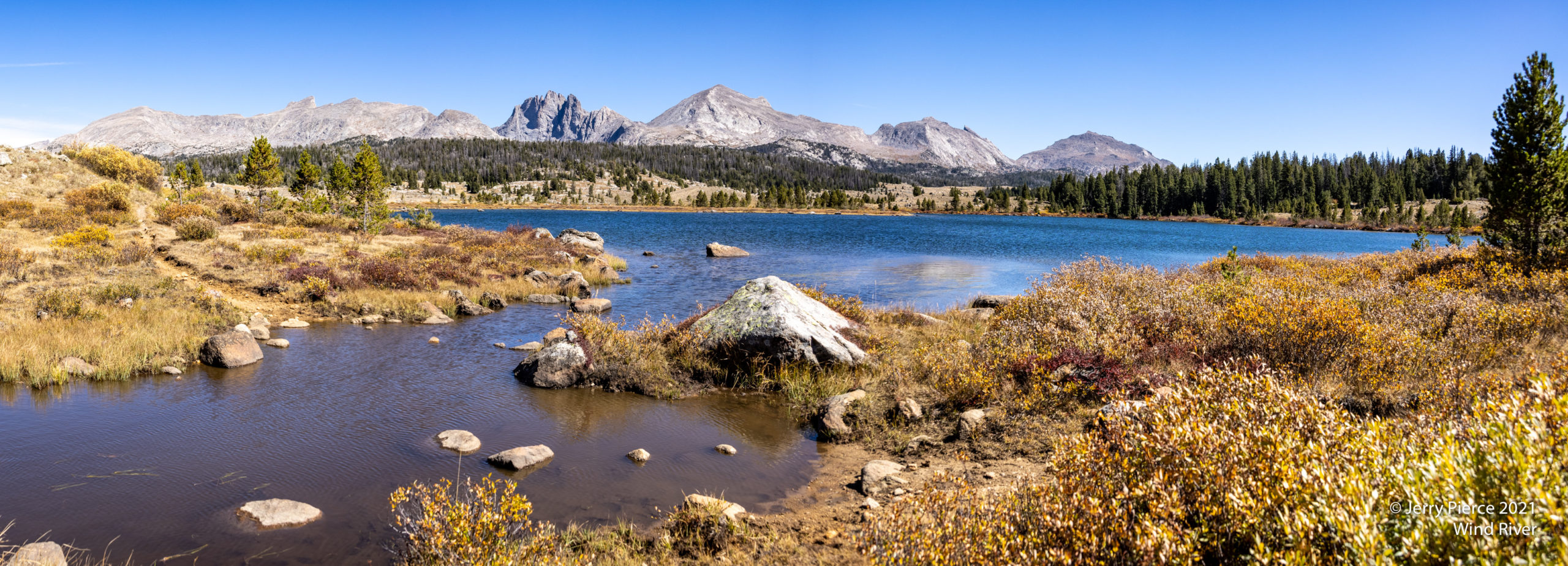
We are now headed south Over Hay Pass (really? This pass had a name? Couldn’t tell.) back to the other side of the Continental Divide and past a batch of lakes. Dennis Lake, Beth Lake, Barbara Lake, North Fork Lake, Glacier Lake and a number of un-named lakes.
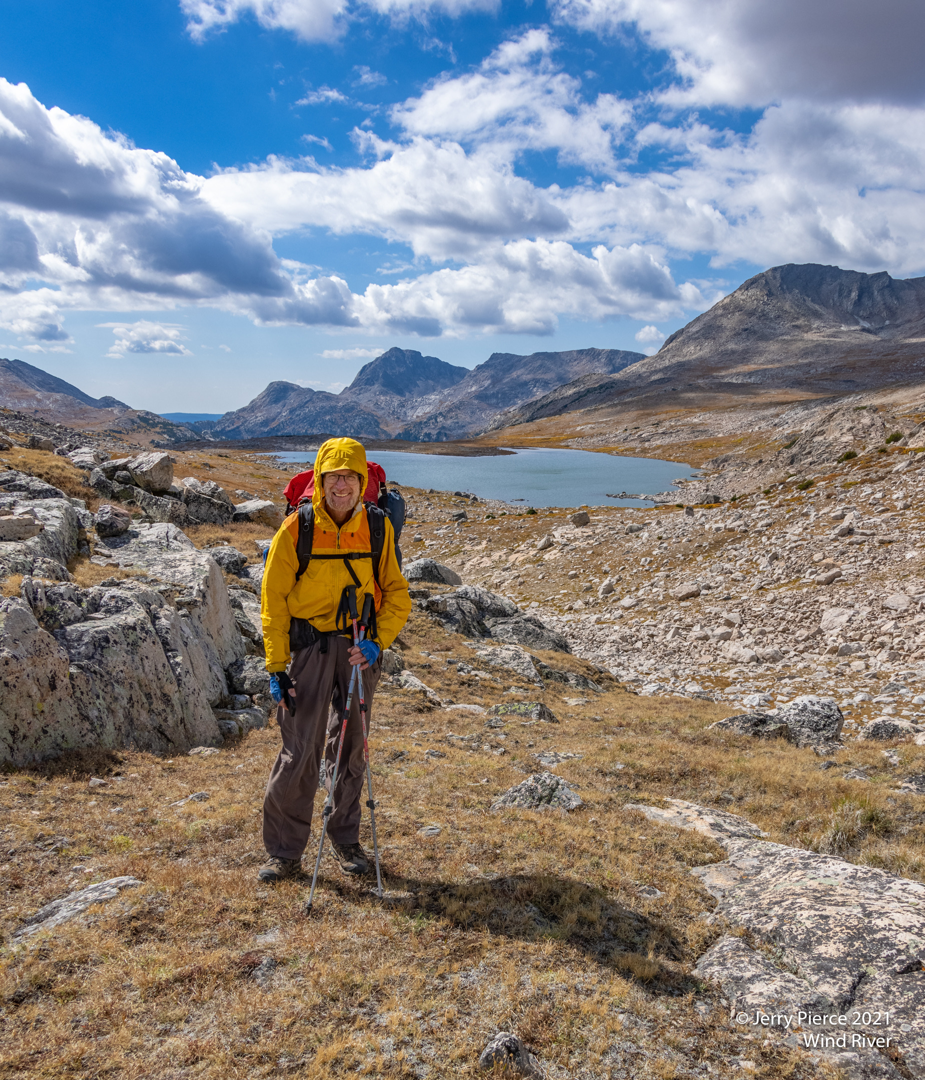
This is Scott on Hay Pass looking toward Beth Lake.
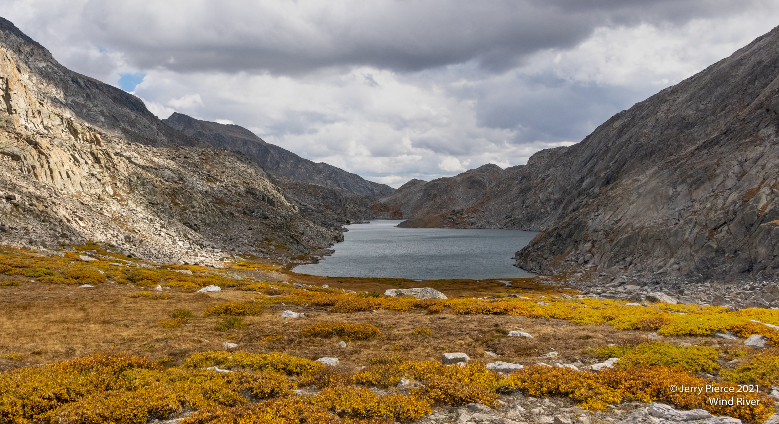
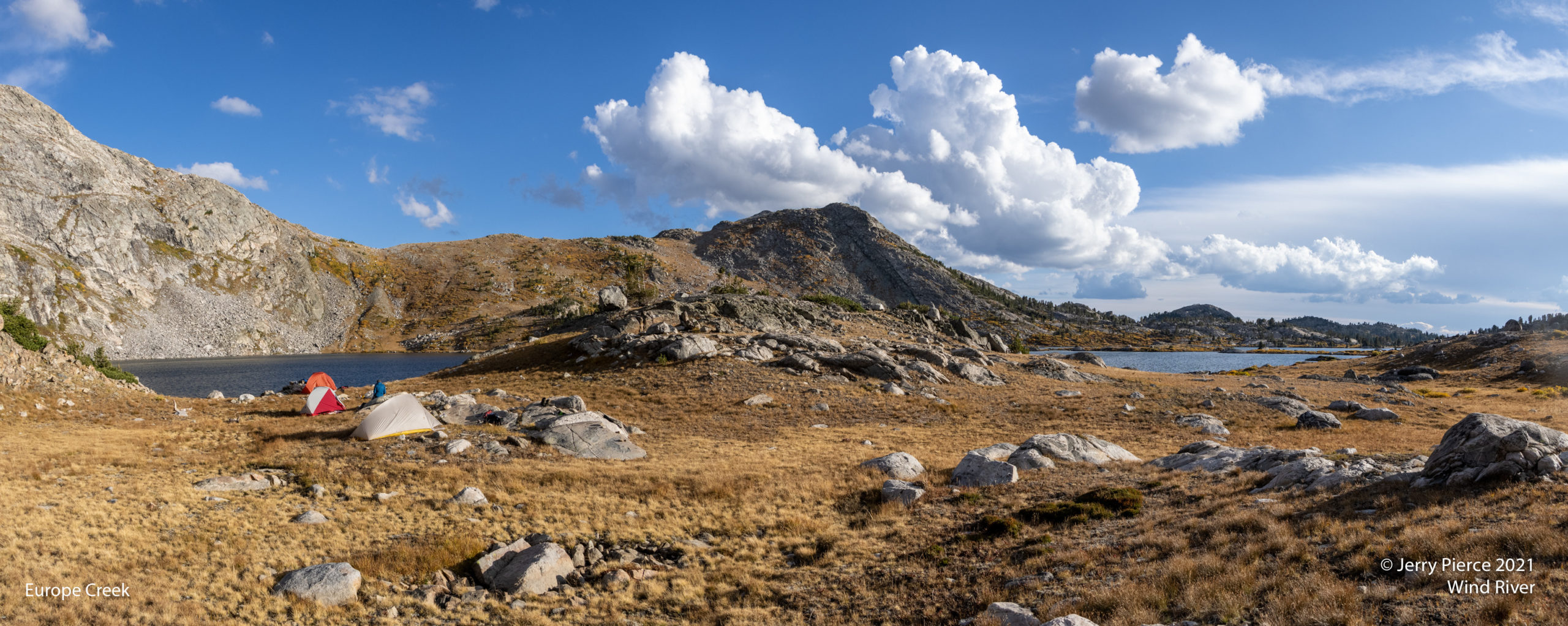
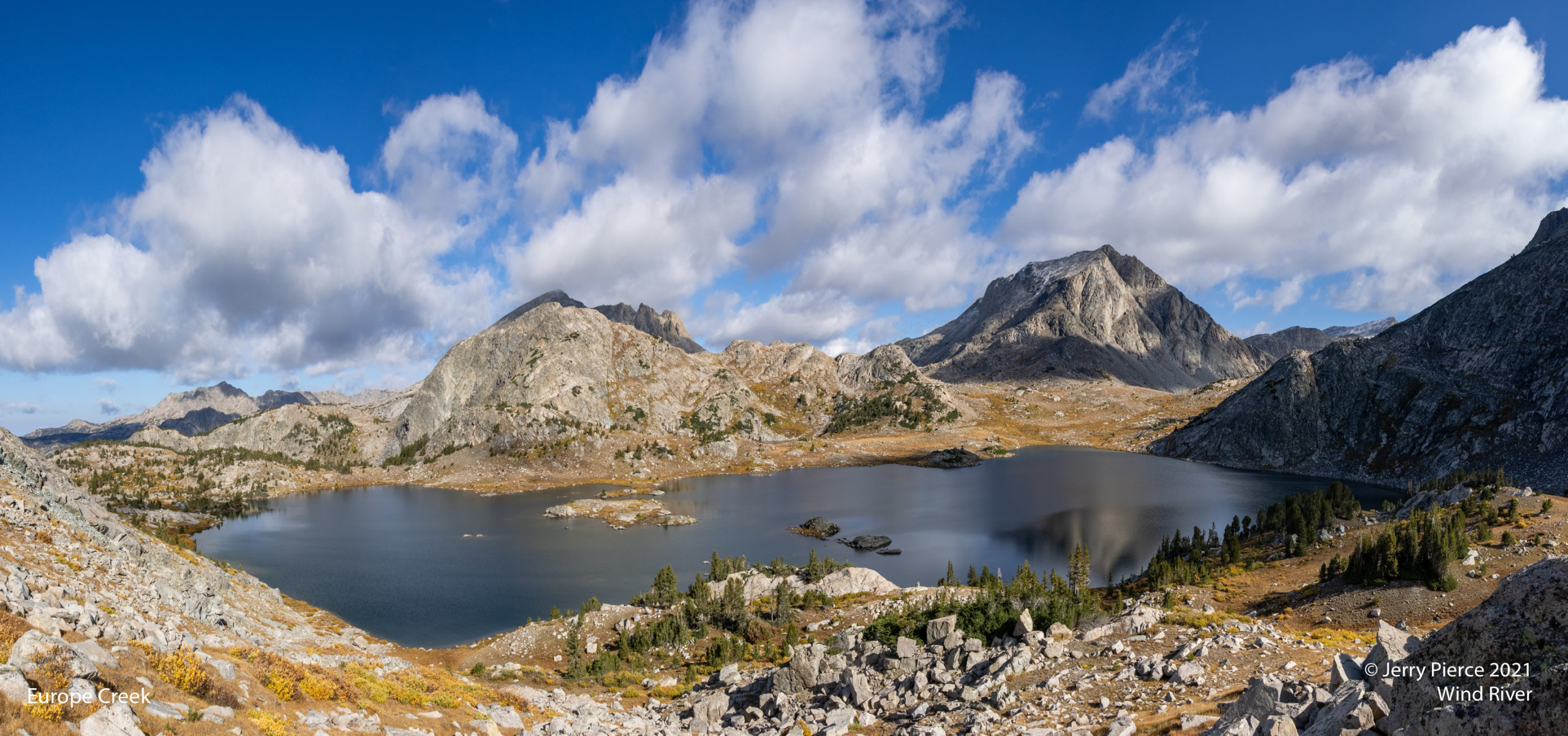
Long Lake – we would be going to the left of the lake and beyond. Long Lake lived up to it’s name and got us into the Europe Creek area (with numbered lakes)
Europe Creek Lake number 4 – we settled in for the night. The next day we would be going over the pass just above our tents.
And we got back on schedule! We got in a little early in the day so we were able to do some laundry. We went to bed and all’s well – except when it decided to begin to rain / hail and what-ever! Nice storm – we heard from other campers that there was a lightning storm with it, but none of us heard it. In the morning we found our tents were covered in ICE! And the hills had a nice cover of hail/snow? It was chilly!
Off past SO MANY LAKES on the way to Bewmark Lake, specifically Lake 10935 (named after the marking the USGS topo map). It may also be called Bewmark Bench. We did an evening walk for a mile or so to Photo Pass. Not sure WHY they called it photo pass. Not great views, but it did look north into the Indian area of Wind River. We had some haze in the air from a fire that started on the eastern side of WR.
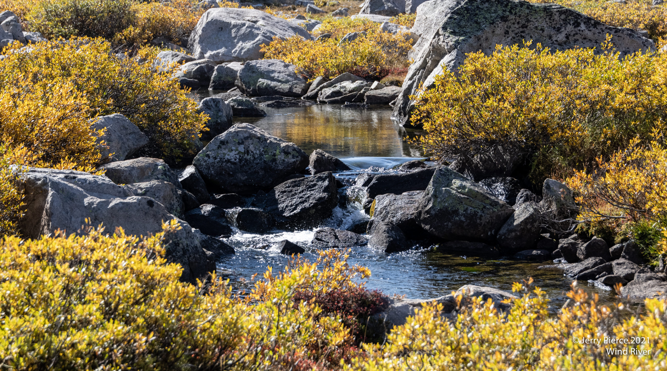
Crossing the outlet of Europe Creek Lake #4
Our campsite at Bewmark Bench was somewhat protected by the boulders. It was still windy!
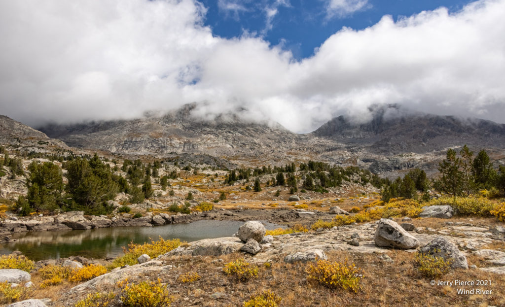
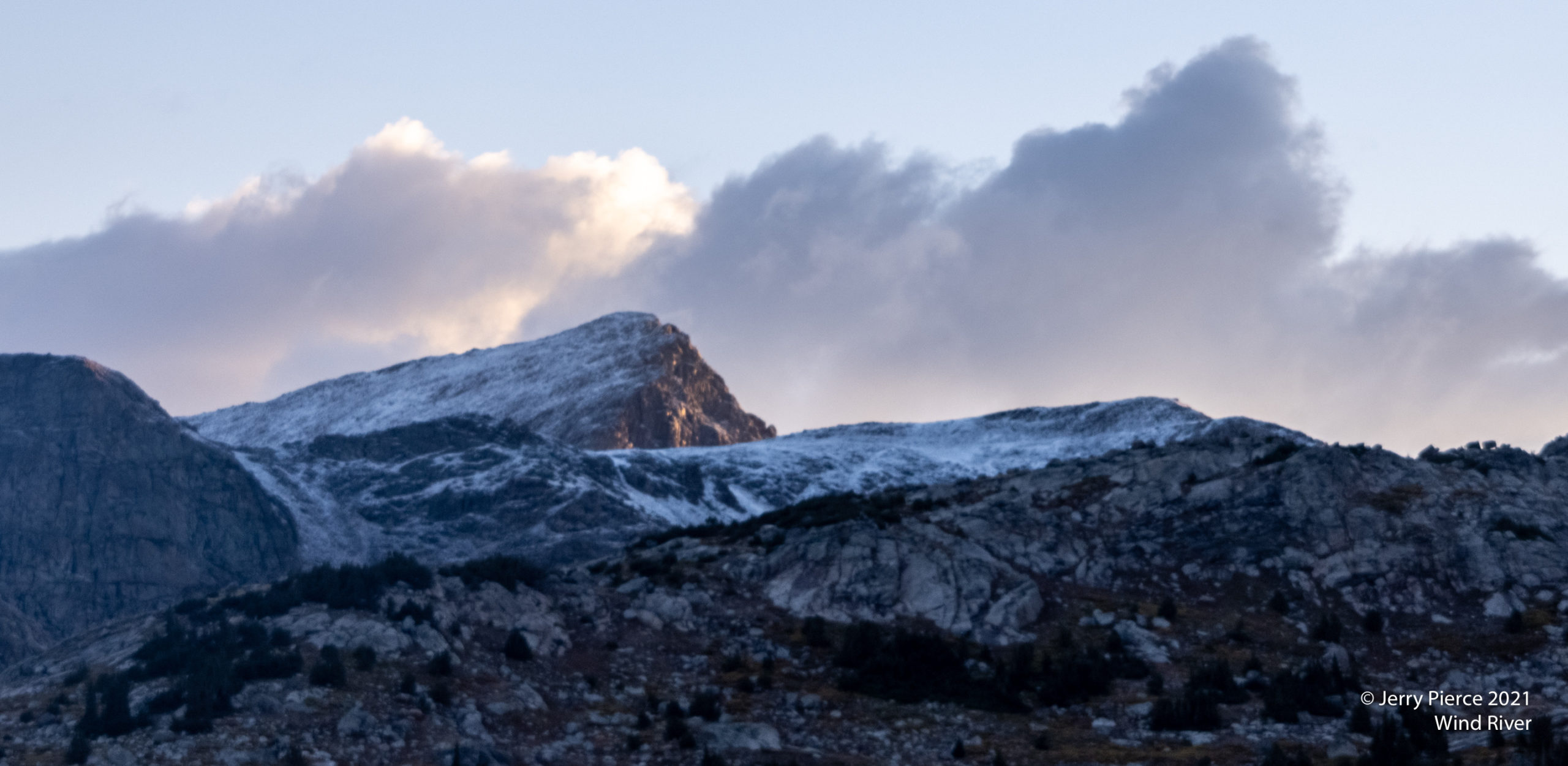
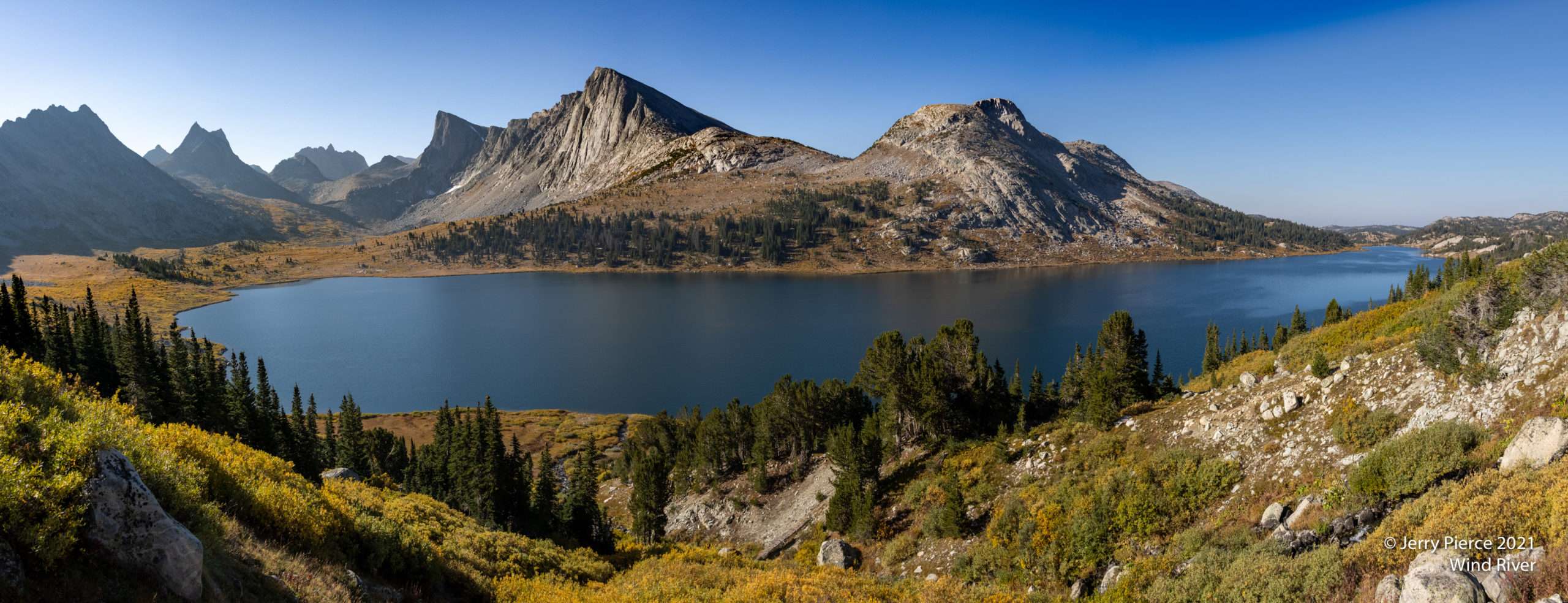
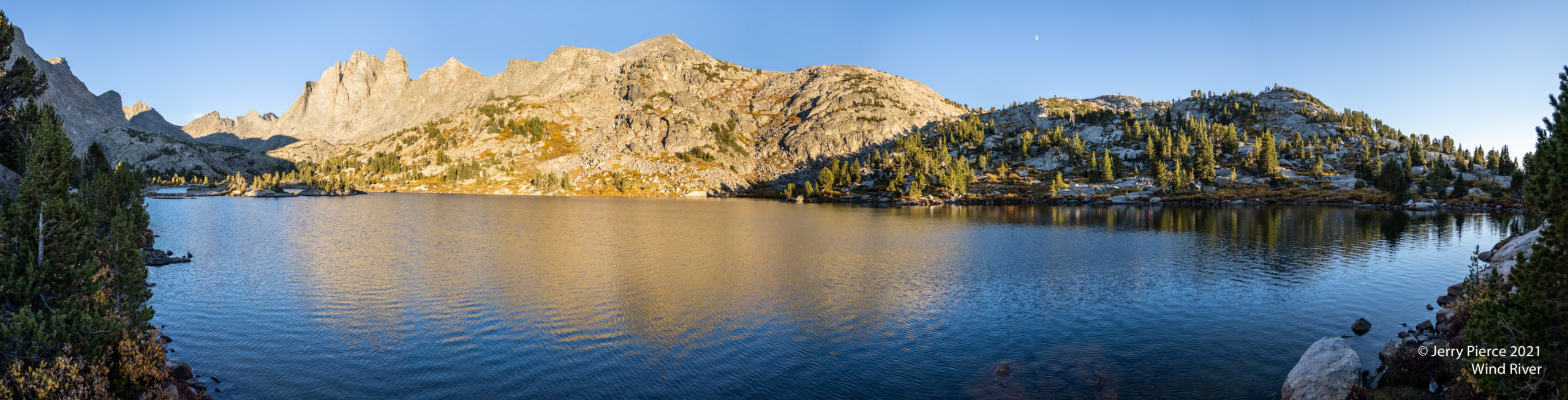
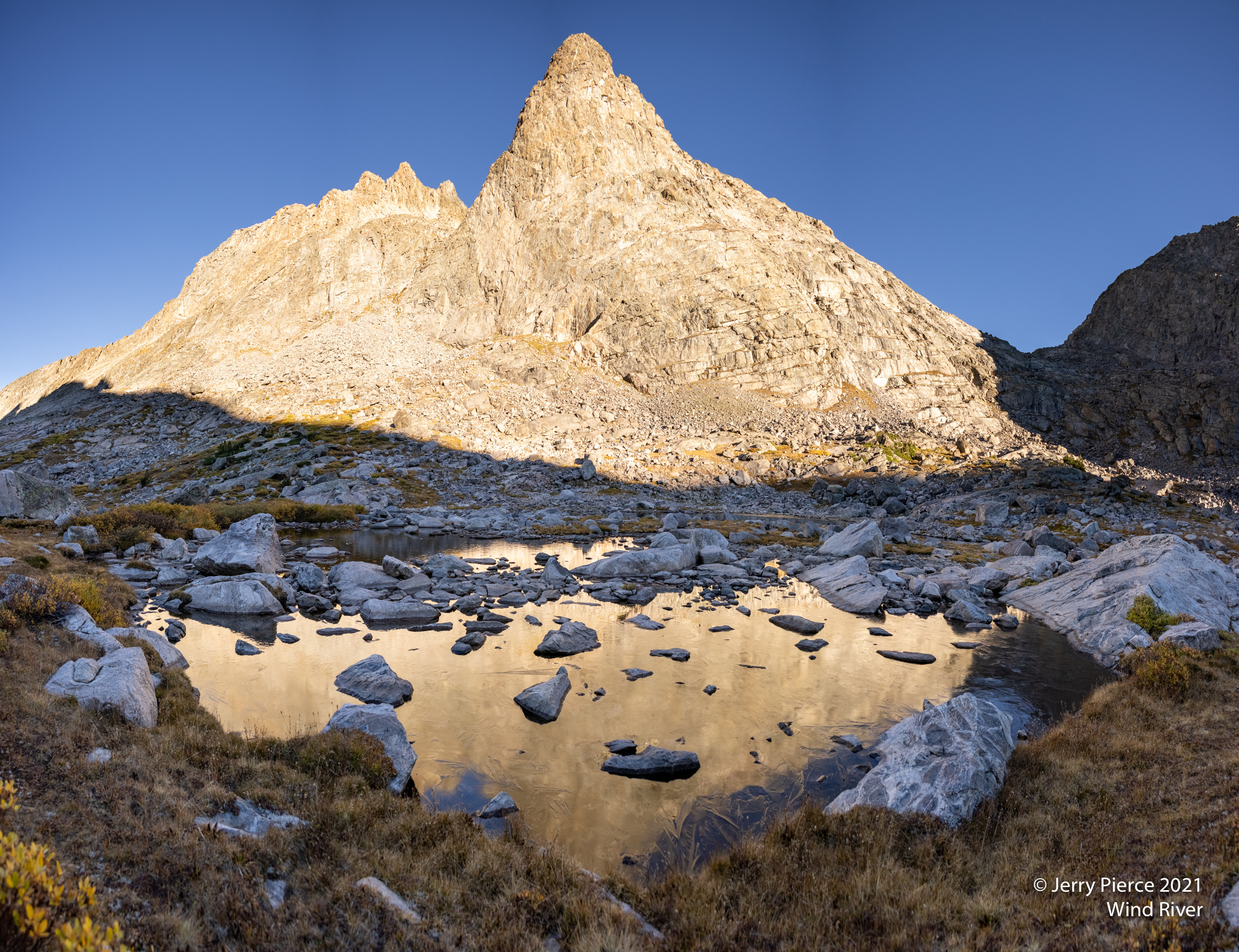
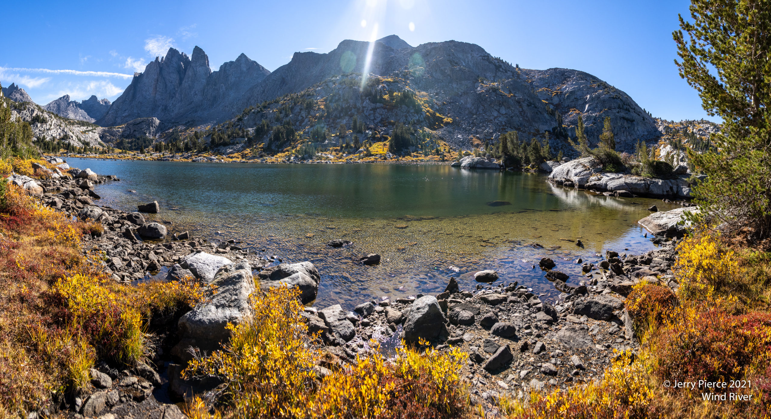
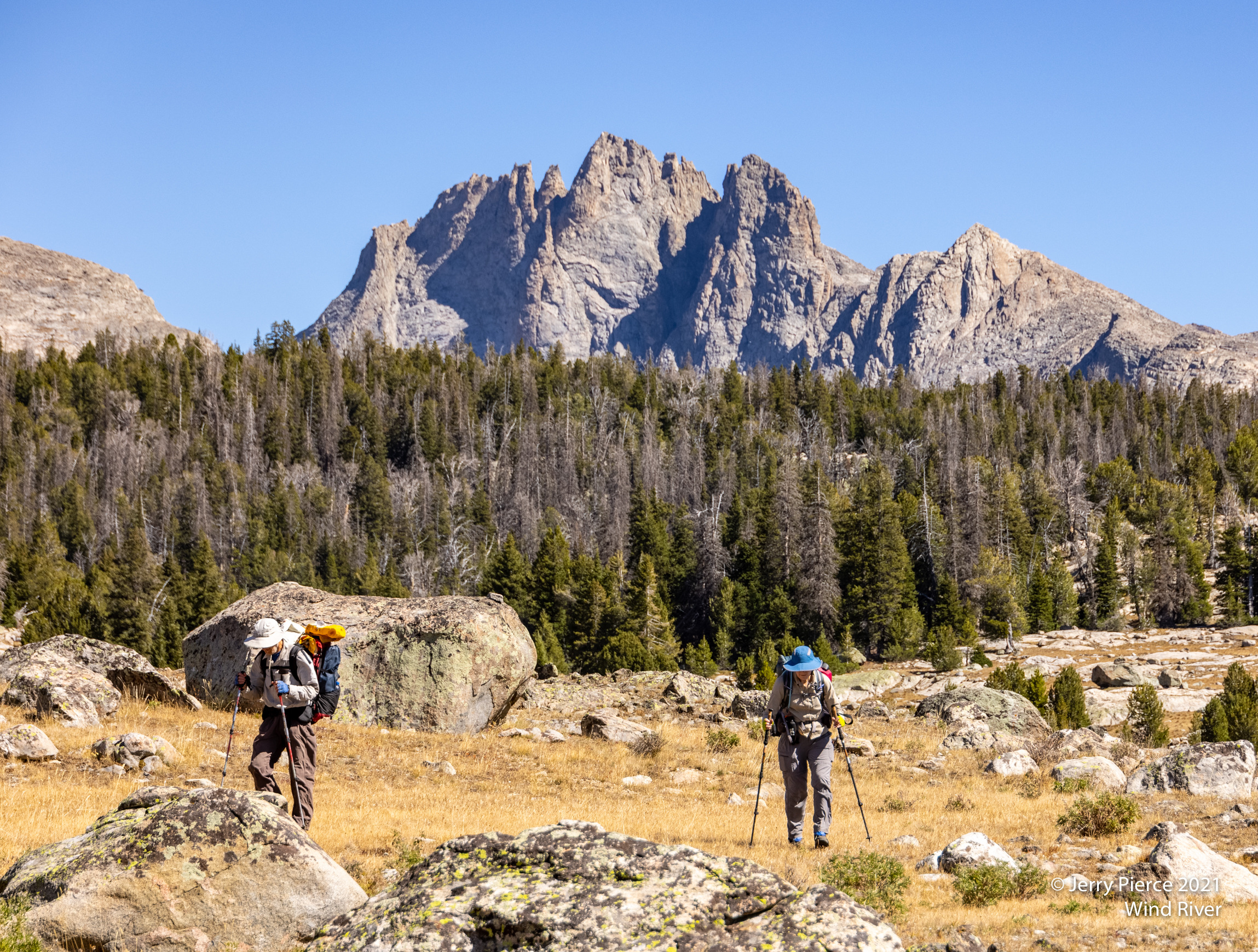
We began to see the “real” Continental Divide with the stunning peaks.
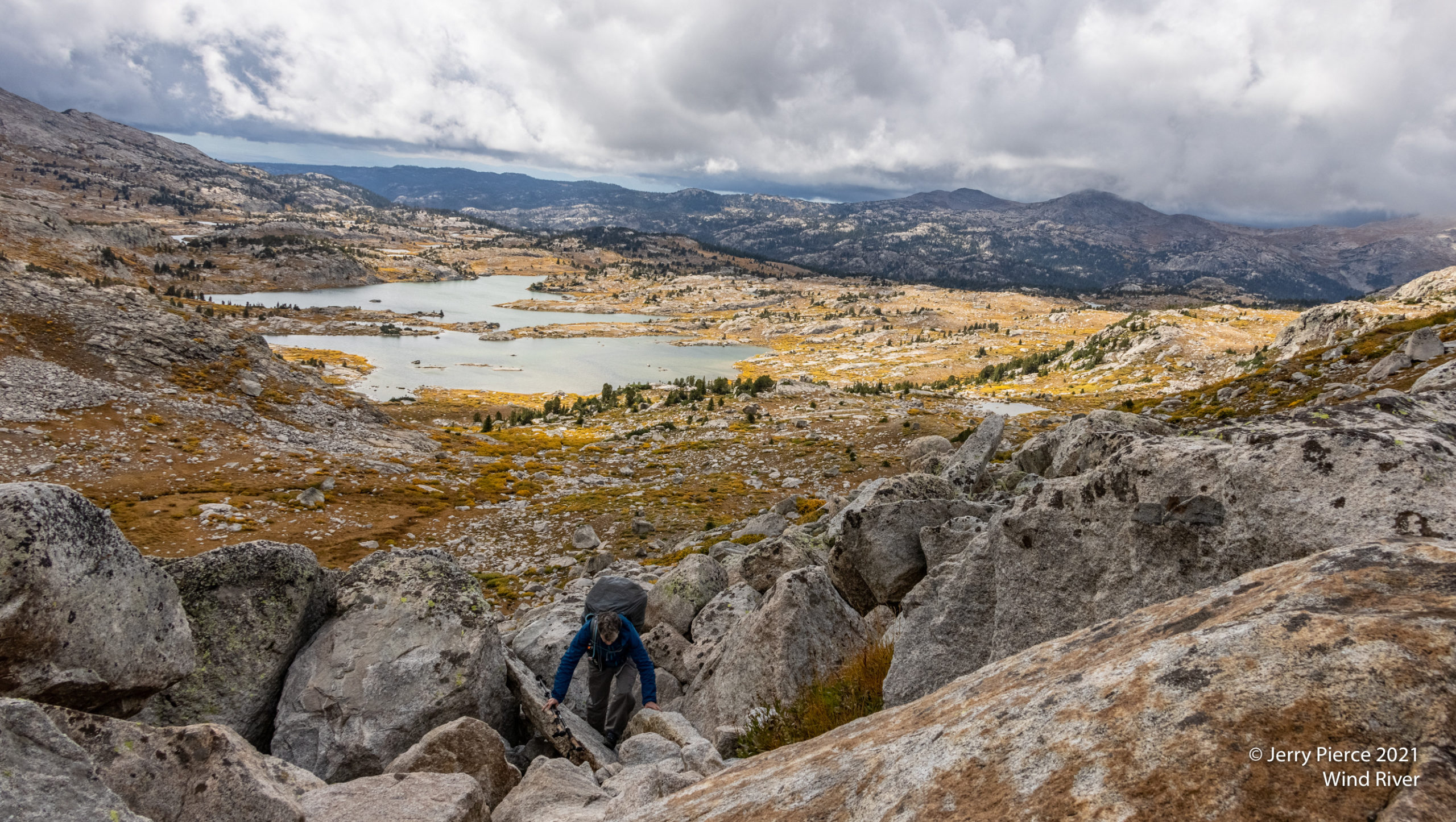
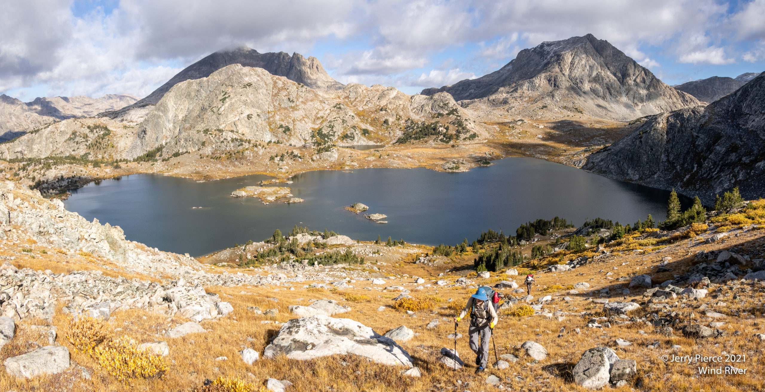
We had a choice for the next leg of our journey – go the “high” route or “low” route. We decided that given the weather it would be wise to go low. We went by this HUGE Middle Fork Lake to go over the pass directly over the lake in this picture. (The high route would have gone up the pass to the left.)
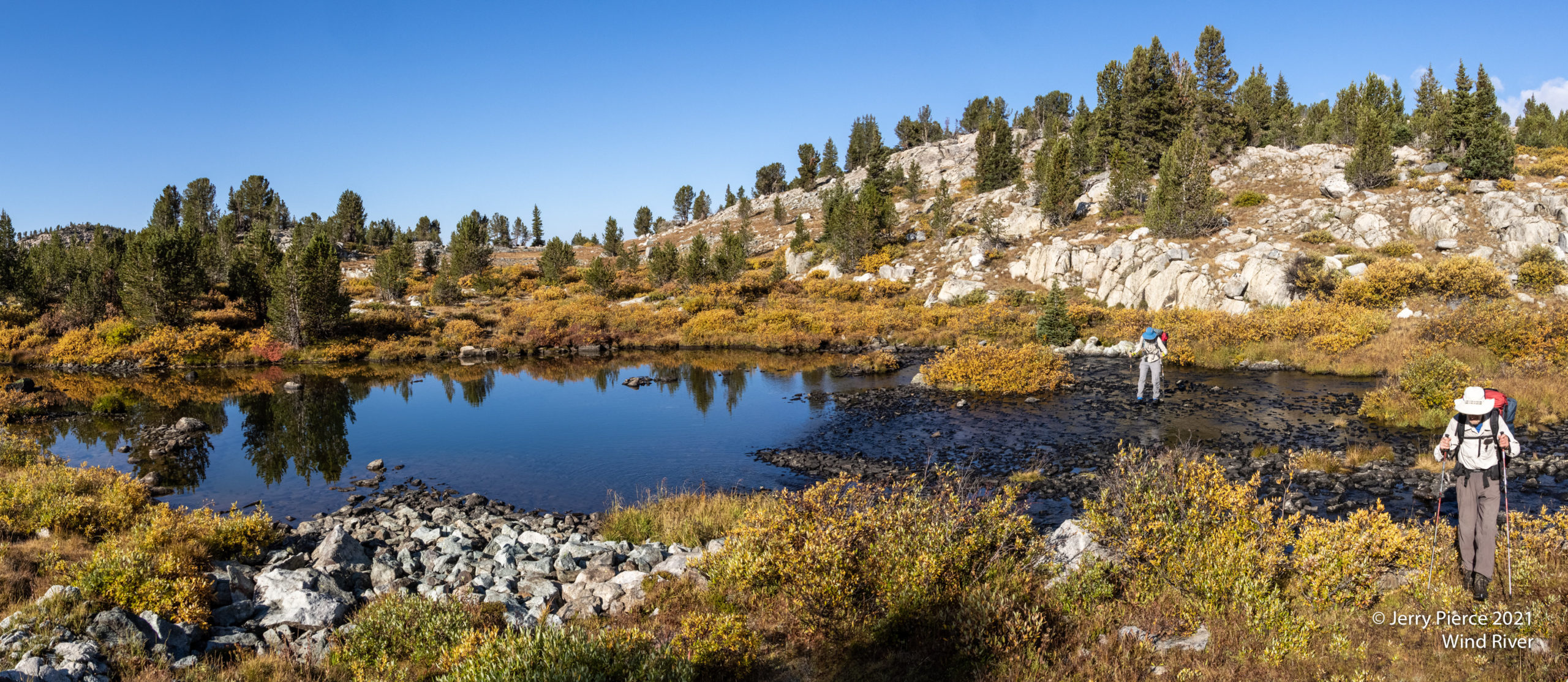
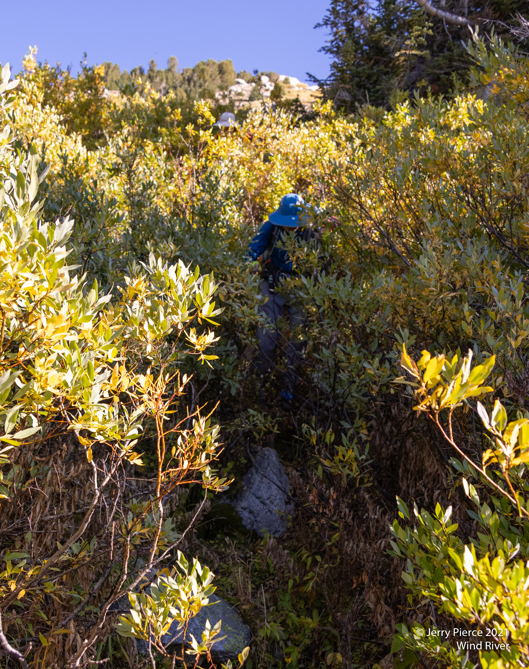
Somewhat lost in the bushes it took a little bit of work to follow the trail … what trail you may ask?
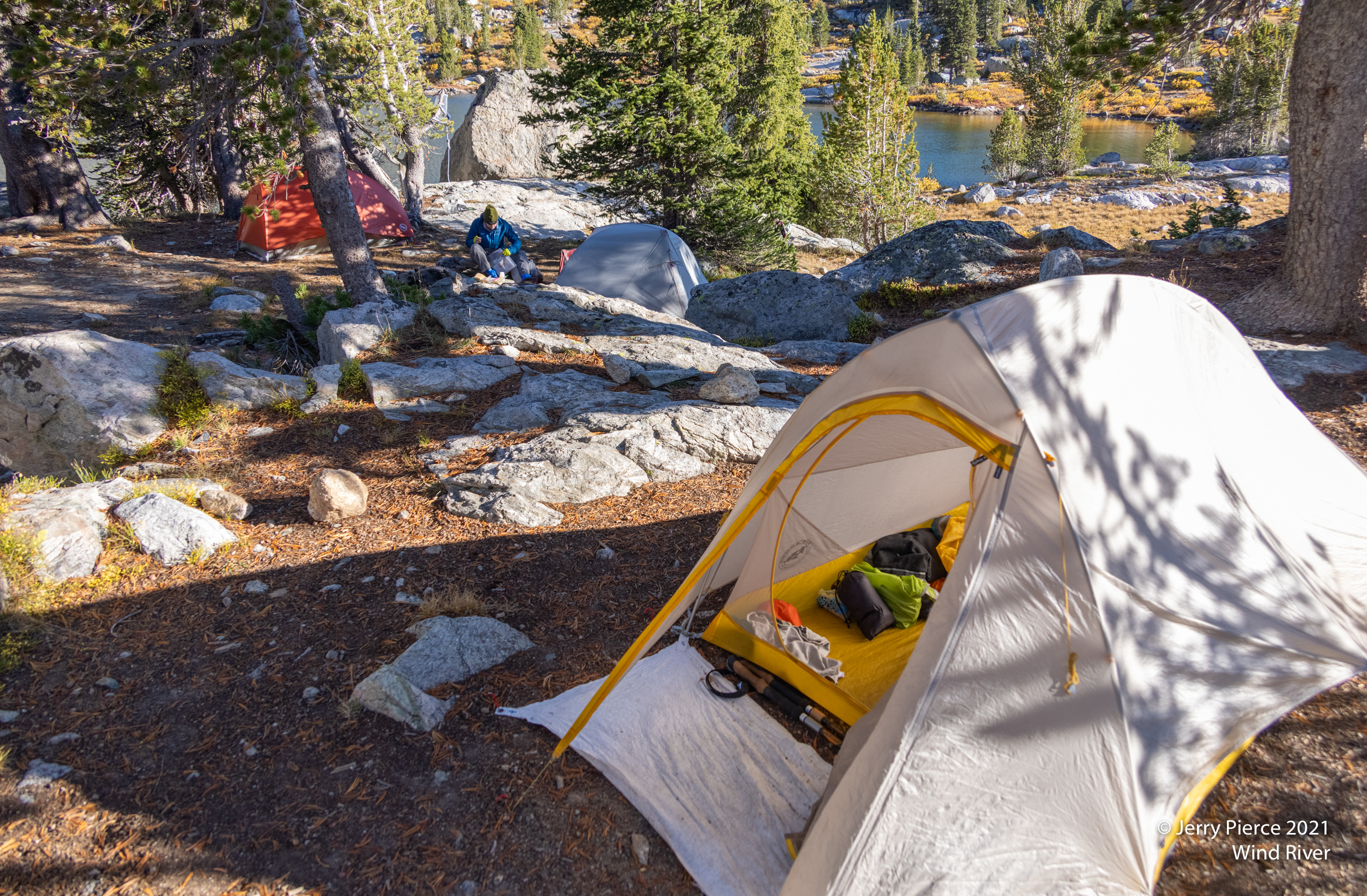
Final approach to Bonneville Lakes
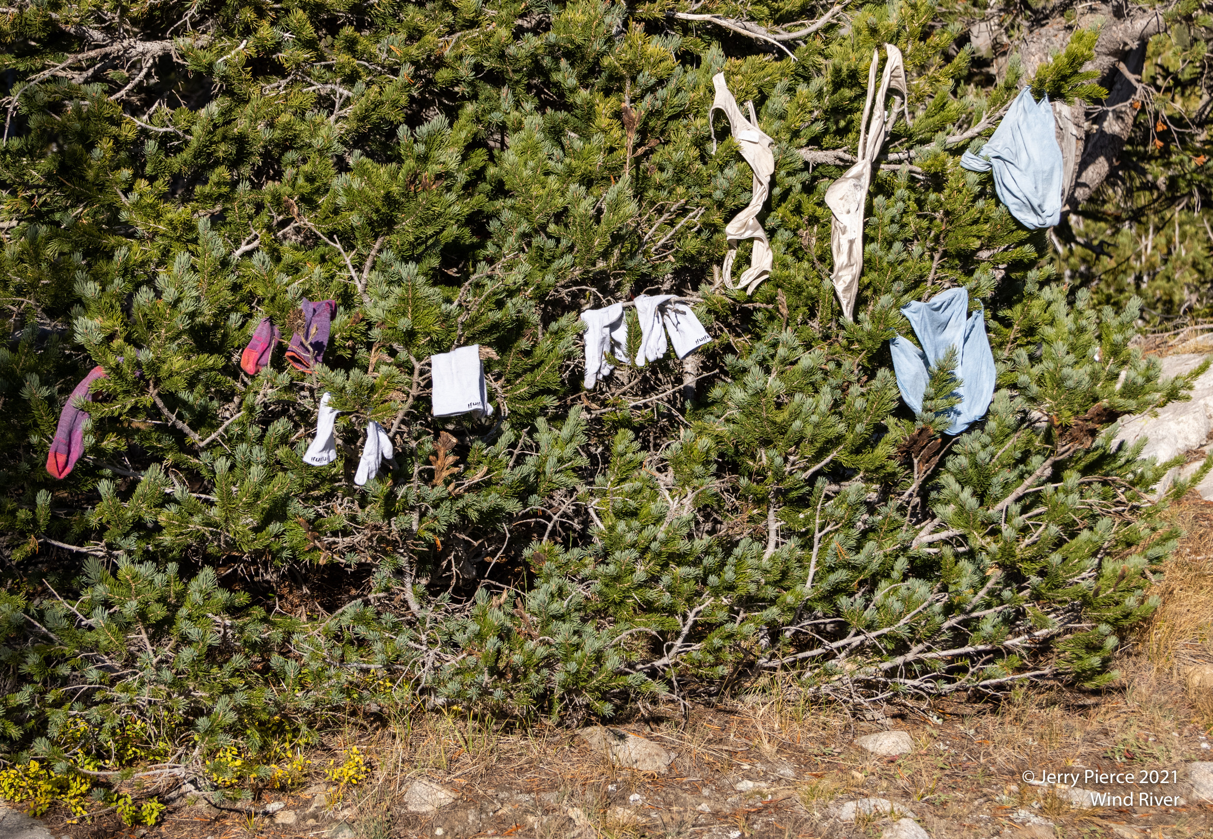
We again arrived in camp a bit early so it gave us some time to enjoy the lake.
And get some more laundry done! 🙂
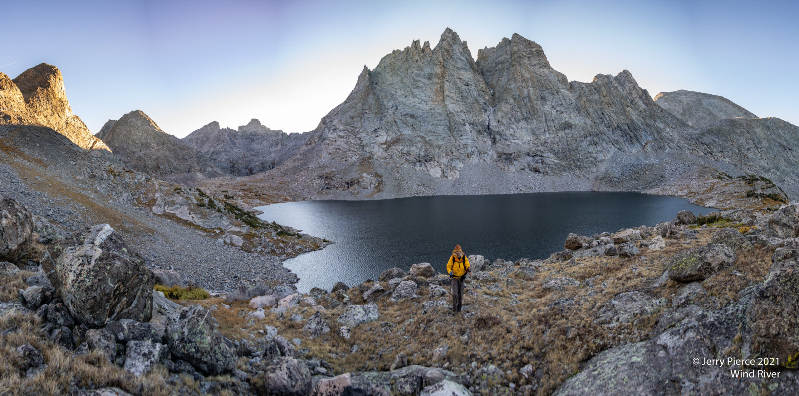
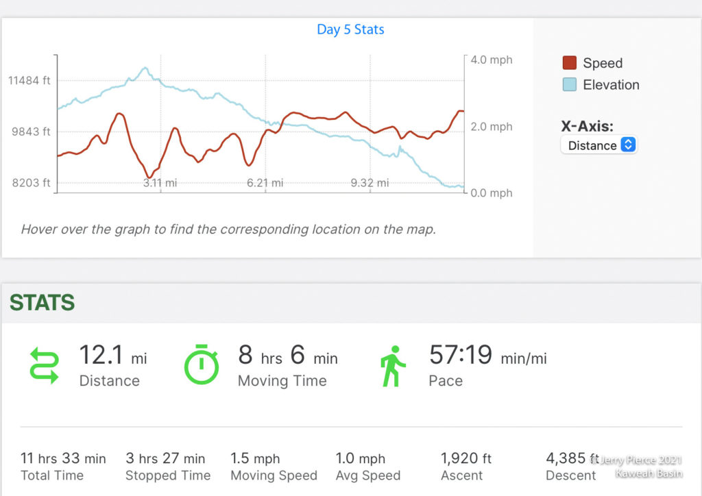
The next morning we decided to do a “day hike” before we took off for a long trek to the next camp. I was not happy with the concept … I like my day hike at the end of the day, but I went with the group – was I glad we did it!! Ended up being some of the prettiest area of the trip. Sheila Lake, in particular, was at the foot of the tall peaks of the Continental Divide. The photos were marginal, but the mental images were wonderful!
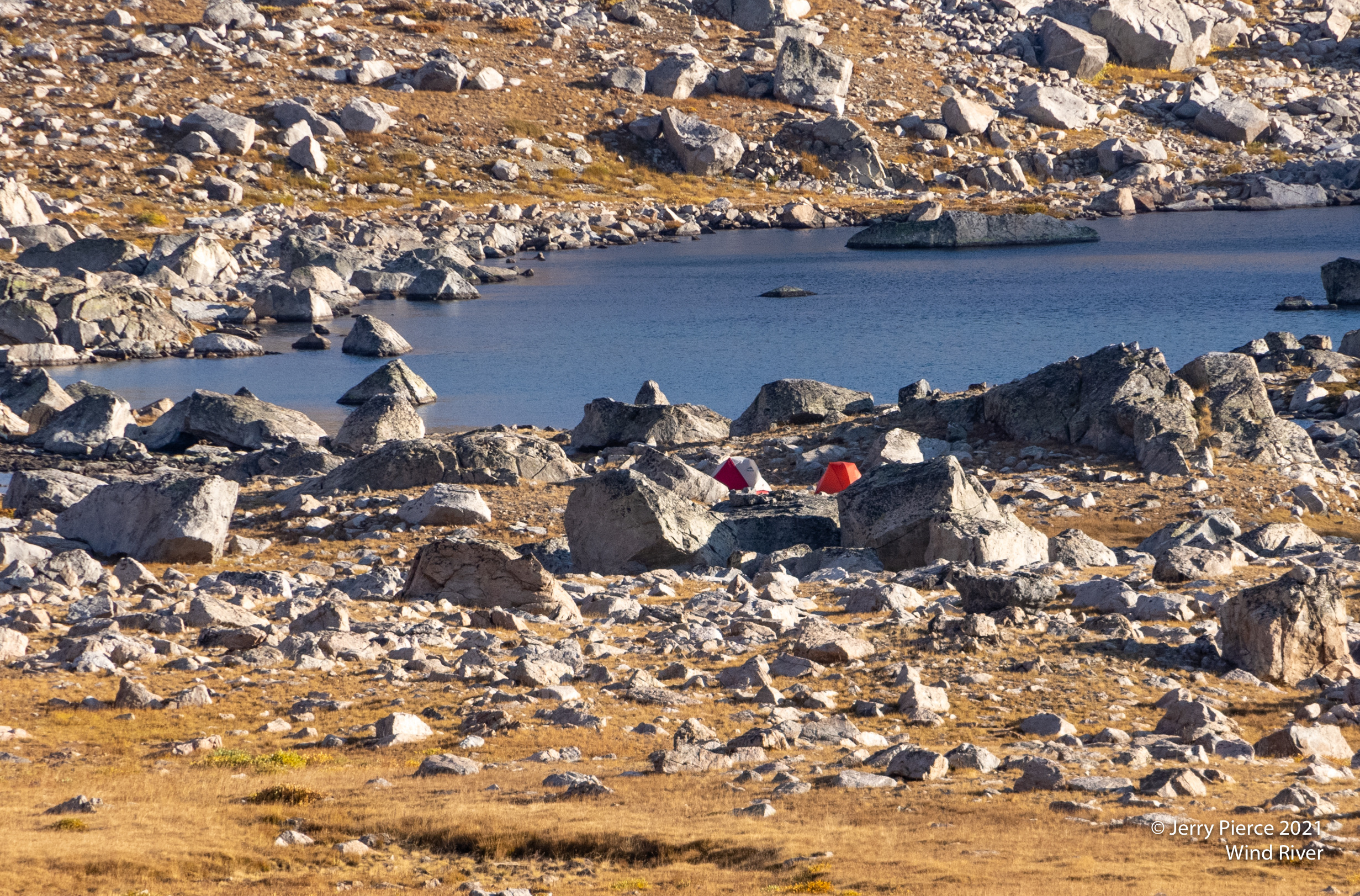
On the return from our morning hike, looking down at Bonneville Lake – our campsite is at the right side, far end.
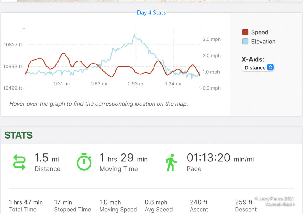
Then the long trek began. We covered a total of 14 miles, mostly downhill, mostly on-trail. So actually a pretty easy day (especially since our packs are much lighter now!)
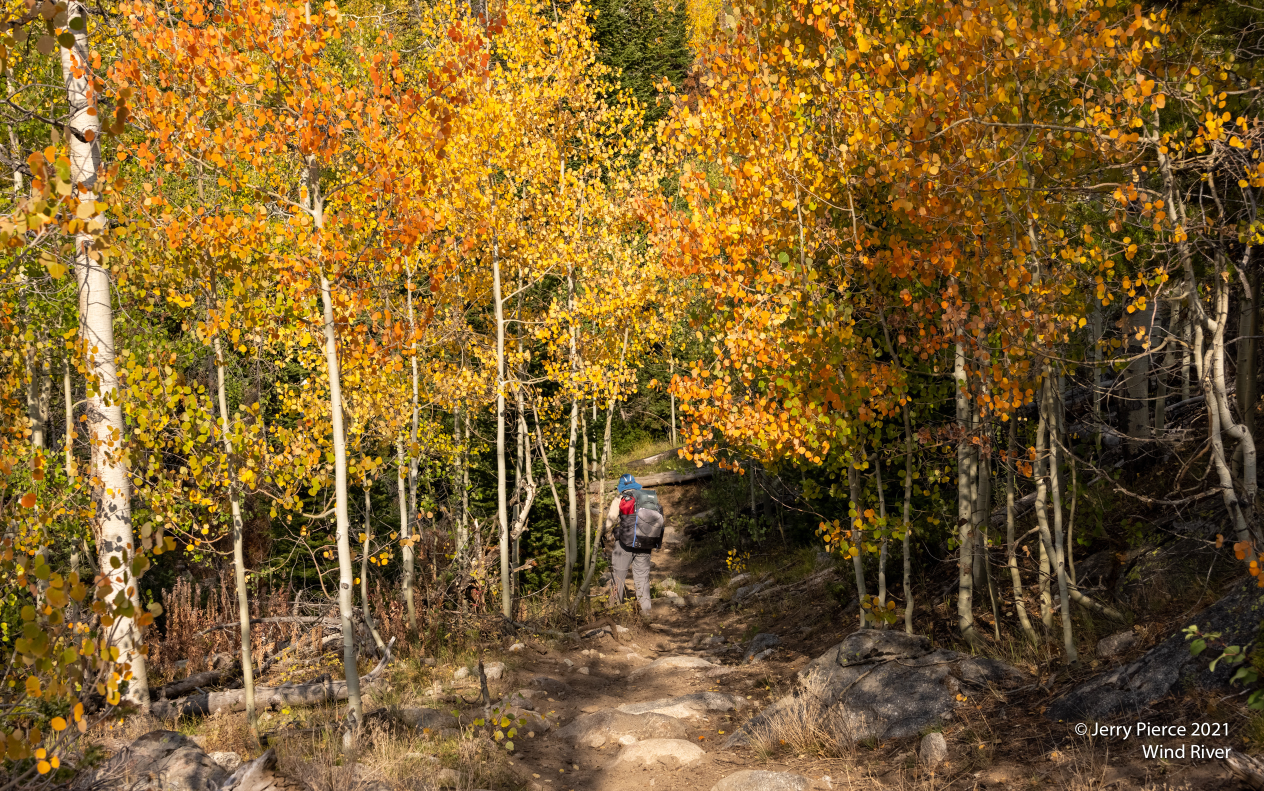
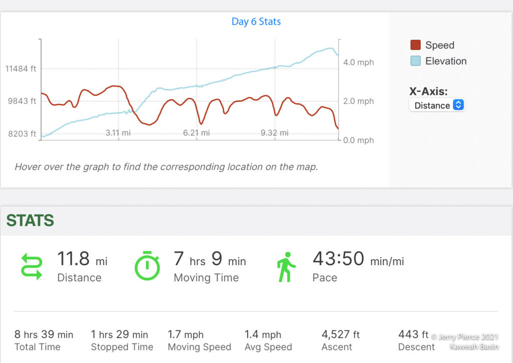
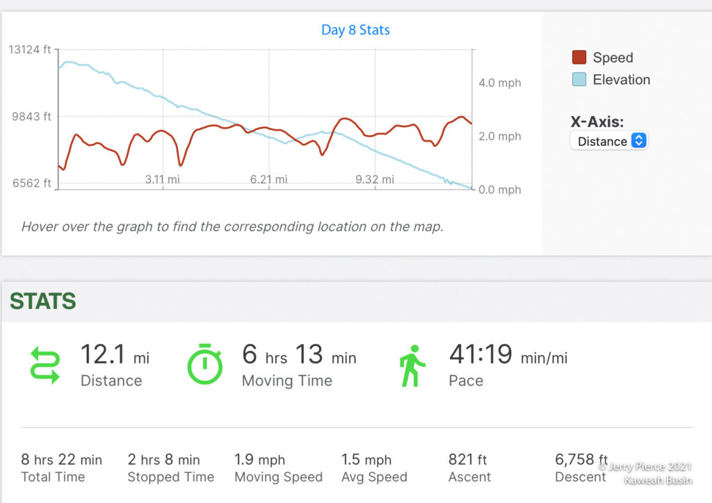
Last day and the hike out. A fairly short trek (about 6 miles) so we could get to the cars and begin our long drive home. We began to see the Aspen trees turning color and the changes as we went down to the trailhead.